
Mason City Neighbor Record Layers
The area around a Mason City address can be read through several official and community layers. Each answers a narrower question. The county map outlines parcels and supplies IDs. Tax and assessment systems connect those parcels to account or owner fields. Recorded instruments explain transfers and interests. Permits describe projects. Historical directories give dated address clues, while associations describe a self-defined community rather than everyone on a block.
| Block source | What the source reveals | Access and limit |
|---|---|---|
| County GIS Tax Parcels and Parcel Points | Adjacent polygons, IDs, lots, roads, subdivision, and dimension context | Map or REST query; not a survey or occupant list |
| County tax portal | Parcel, owner, house, street, city, and unit search | Online one parcel at a time; no ZIP field |
| Assessor and Beacon | Owner, summary, sales, parcel, and map leads | Pre-1995 sales require paper records |
| Recorder and Iowa Land Records | Deeds, mortgages, easements, liens, releases, and parties | Index and documents; not a household roster |
| SmartGov permits | Address-keyed project, status, inspection, and document clues | Public portal or Chapter 22 request; not occupancy proof |
| Voter records | Individual registration or polling context; lists by lawful request | Chapter 48A purposes and privacy rules apply |
| Community associations | Rules, covenants, board, contact, and community history | Self-published; no complete member roster established |
Use the parcel layer as the base. Add sources only to answer a defined question. If the goal expands to every address on a long road, the Mason City street directory has the full named-street workflow.
Map Mason City Neighbors by Parcel
The official Cerro Gordo real-estate map is the visual route. Its application did not render during unattended research, but the underlying Tax Parcels service confirms query, identify, find, map export, polygon, point, road, lot, subdivision, section, and annotation layers. The inspected parcel-point schema contains PIN and ParcelID fields, not an owner name. Ownership must be checked in assessor, tax, or deed records.
- Validate the starting address and preserve house number, direction, street suffix, unit, city, ZIP, and source date.
- Locate its polygon through the county viewer or use Find, Query, or Identify in the map service.
- Record the subject PIN or ParcelID and each touching or nearby parcel ID. Do not rely on visual boundaries as a survey.
- Open each selected parcel in the county tax portal or assessor route. Label each result as an owner or account field, not an occupant.
- Check a deed or permit only when it answers a transfer, easement, project, or boundary question. Save the source and access date.
This small-radius method keeps the neighbor search focused. Roads, railroads, lots, corporate limits, cemeteries, and subdivisions can explain why the nearest parcels do not form a neat row. The service permits selections up to 2,000 records, but a large export is rarely needed to understand one Mason City block.
Mason City Owners Are Not Occupants
An assessment owner is the person or entity tied to valuation. A tax account supports billing. A deed party transferred or received an interest on a recorded date. A permit applicant is linked to a project. None is automatically the person who lives at the street address. Mailing and situs roles may differ, and the exact local Beacon field order was not visible during research.
Compare dates before connecting records. The county tax search accepts parcel, owner, house, street, city, and unit controls, but not ZIP. The assessor says computerized sales omit pre-1995 transactions. For those, phone or visit the Mason City or Cerro Gordo assessor and ask for paper records. Recorder documents can then explain a transfer without turning the index into a current neighbors list.
- Parcel
- A mapped unit used to organize land and assessment records.
- Situs address
- The street location assigned to the parcel, which can differ from a mailing address.
- PIN
- A parcel identifier used to connect map and property records.
- Plat
- A recorded drawing that lays out lots, blocks, streets, or a subdivision.
Mason City Community Directory Leads
No official citywide neighborhood-association roster or boundary map was found. Two self-published sources do provide real community context. They must be labeled as private association material, not city-designated boundaries and not public directories of Mason City neighbors.
Asbury Farm
Asbury Farm HOA publishes community documents, covenants, rules, board information, and a contact route. No public member household roster was established.
Sunset Ridge
Sunset Ridge publishes association history and neighborhood context. Verify any claimed boundary through plats, city records, or association documents.
To verify a community name, search the Mason City code and ordinance record, county subdivision and plat layers, Iowa Secretary of State entity records, and the group's own governing documents. A marketing label, subdivision, association, and city neighborhood can cover different areas. Ask the group directly about membership and document access instead of scraping names from posts.
Mason City Neighbors in 1958
The Library of Congress telephone-directory OCR preserves a dated Mason City street and subscriber layer, including quadrants, civic landmarks, residence and business labels, and old GA telephone exchanges.
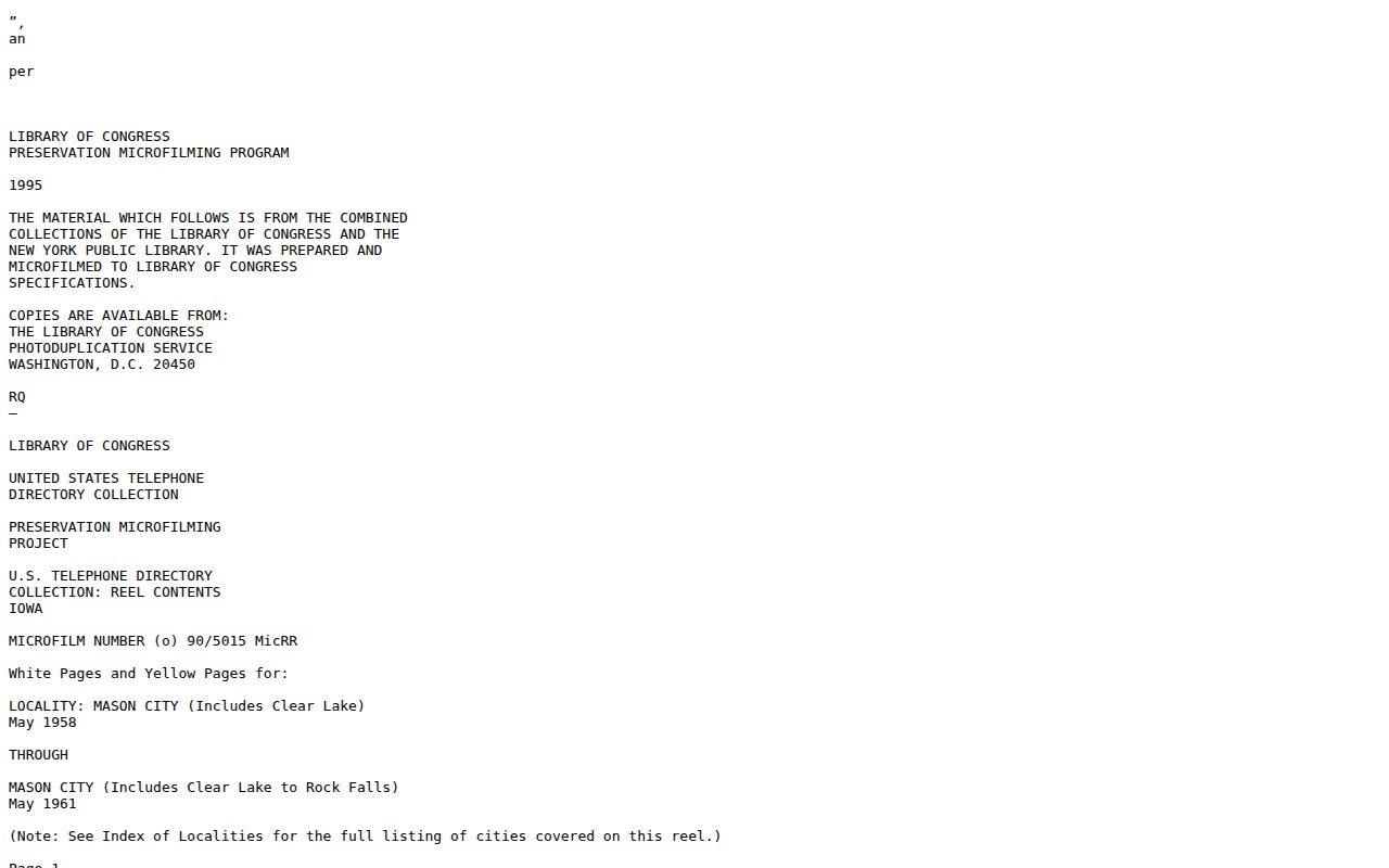
The captured text helps show how one historical directory entry was structured. It cannot identify present neighbors, and OCR spelling or line breaks should always be checked against the scanned page.
The May 1958-May 1961 directory can orient a historical block when paired with plats, deeds, and the public 1950 census. It is especially useful for quadrant marks and institutions that acted as map anchors. A railroad, school, court, hospital, or library reference helps place a street, but does not prove that any named person lived next to it.
Mason City Voter Block Limits
Iowa's individual voter lookup asks for first and last name, ZIP, house number, and birth month, day, and year. It does not offer a public command to enter one street and list all voters. Cerro Gordo's polling finder is keyed to ZIP and election information. Neither route should be used to assemble a casual block roster.
Chapter 48A permits public inspection and list requests through the Secretary of State or county Auditor, subject to preparation costs, removed identifiers, a public recipient log, and strict use categories. Commercial use is prohibited. No official block-level interface or stable Mason City precinct map was found. The practical fallback is the county Auditor by phone, written request, or in-person inquiry, with the permitted purpose and requested geography stated clearly.
Note: Voter status and polling data do not prove current occupancy or reveal every adult on a Mason City block.
Mason City Neighbor Source Choices
Official records and compiled commercial tools serve different roles. The public source is slower because the researcher must compare dates and record types, but it exposes the custodian and correction route. Commercial compilation may merge names, phones, and addresses from old feeds without showing why two records were joined.
| Choice | Useful strength | Main caution |
|---|---|---|
| County GIS and tax systems | Parcel-specific map and account fields | Owner or account is not necessarily an occupant |
| Recorder and permit files | Dated instrument or project evidence | Parties and applicants have record-specific roles |
| Association pages | Local rules, contacts, and self-described community context | Not municipal rosters or proof of all members |
| Commercial neighbor tools | Fast compiled leads | Stale links, unclear sourcing, possible fees, and harder correction |
When an official field is wrong, note the parcel, instrument, permit, or account number and contact the actual custodian. A commercial opt-out does not erase the underlying public record. Give any compilation service only the minimum data needed for a correction or removal request.
Mason City and County Maps Differ
Mason City GIS supplies city limits, roads, imagery, and municipal infrastructure or asset context. Cerro Gordo GIS supplies the county parcel layer used for adjacent-property work. A hydrant, sewer, GPS asset, or city boundary layer is not an ownership roll. Check the source agency and layer name before drawing a conclusion about your neighbors.
Street forms also require care. Preserve a directional prefix or quadrant, unit, and suffix. No official Mason City conversion table or definitive renumbering year was located. When an old and current address appear related, compare the city map, county parcels, plats, directories, and legal descriptions. If no dated source proves the conversion, state the gap.
Mason City Block Record Fallbacks
When a portal fails, the county GIS office can answer map-layer and adjacent-parcel questions by phone, email, or in person. Assessor staff can explain older paper sales. The Recorder offers online, counter, phone, email, mail, and copy routes for instruments. SmartGov supplies permit access, while City Hall can arrange review of originals with advance notice.
For an existing nonconfidential record not online, Iowa Chapter 22 allows in-person, written, telephone, or electronic requests to the custodian. Identify one block, parcel IDs, one record family, and a date range. Ask for electronic format and a cost estimate. The law allows reasonable actual retrieval, copy, and supervision costs, and permits redaction of confidential fields rather than withholding every public part.
Protect Your Mason City Neighbors
Exact dates of birth, driver identifiers, private phones and email, victim or juvenile details, confidential vital and court data, and protected physical addresses do not belong in a neighborhood file. Iowa Safe at Home offers a substitute address, mail forwarding, and confidential voter participation for qualifying survivors. Do not try to work backward from that substitute address.
Use parcel and community sources for civic curiosity, local history, reaching the proper association, or checking a property-related claim. Record what the source actually says and when it said it. If ownership, occupancy, or boundary evidence conflicts, leave the result open and contact the custodian.
Lawful use. Find Mason City neighbors with respect. Never use public records or association material to watch, follow, threaten, harass, intimidate, or harm a person.