
How Mason City ZIP Code Coverage Is Labeled
The Mason City ZIP code directory begins with official postal evidence, not an inferred neighborhood map. USPS sources establish a standard Mason City delivery context, a separate postal or processing context, and a Rock Falls relationship that can be mistaken for city jurisdiction. An exact address must still be checked in the USPS tool because the label table does not assign every street or unit.
| ZIP | Official area evidence | Post office or place context | Research note |
|---|---|---|---|
| 50401 | Primary standard Mason City delivery context | Mason City Post Office, 211 N Delaware Ave Ste 100 | Verify each address; office listing uses 50401-9998 |
| 50402 | Grouped under the Mason City processing label | PO Box or other postal use must be checked with USPS | Do not infer street delivery from a label table |
| 50467 | Cerro Gordo-area postal relationship | Rock Falls is the named community context | Mason City processing does not make it a city-limit address |
This is not a claim that all three are interchangeable Mason City areas. The exact USPS result, city boundary, parcel jurisdiction, and public-record geography are separate fields. That distinction is the key to using the postal directory accurately.
Start a Mason City ZIP Code Search with USPS
The official USPS ZIP Lookup has three useful modes. By Address uses an optional company, street address, apartment or suite, city, state, and ZIP. By City and State returns postal relationships for a place. Cities by ZIP reverses the question and shows place names tied to a code. Preserve units and directional terms because they can change the result.
| USPS mode | Fields supplied | Best Mason City use |
|---|---|---|
| By Address | Company, street, unit, city, state, ZIP | Confirm the postal last line for one exact address |
| By City and State | City and state | Review ZIP relationships associated with Mason City |
| Cities by ZIP | ZIP | Check preferred and accepted place-name context |
USPS warns that its result does not confirm that a person or company is at an address. Use it as the postal layer, then choose a custodian record that matches the real question.
Finding Mason City Records Within One ZIP
A ZIP can narrow a search, but only some public portals accept it. The county tax portal does not. A practical search therefore moves from postal validation to the source-specific record and keeps each result in its proper role.
- Run USPS By Address and record the exact last line, unit, and ZIP+4 if returned.
- Check whether the target portal accepts ZIP directly or needs street, parcel, owner, or city fields.
- Use county GIS and Mason City limits to identify parcel and civic jurisdiction near an edge.
- For an election question, use the SOS form or county polling finder and follow Chapter 48A limits.
- Save source, access date, field labels, and what the result does and does not prove.
Once the search has narrowed to a road and house range, the Mason City street directory guide explains the address-keyed parcel and deed route. This page remains focused on postal granularity.
Which Mason City Public Portals Accept a ZIP?
Portal choice changes the result. USPS validates postal geography. Election tools use ZIP as one part of a regulated lookup. Property tools may need an address or parcel instead. The table prevents a failed ZIP search from being mistaken for a missing record.
| Official portal | ZIP option | Other verified fields | Proper use |
|---|---|---|---|
| USPS ZIP Lookup | Yes, supplied or returned | Street, unit, city, state | Postal address and place relationship |
| Iowa SOS voter lookup | Yes | First/last name, house number, birth month/day/year | Personal election and polling lookup |
| Cerro Gordo polling finder | ZIP dropdown | Polling route | Election location, with county warning |
| County tax search | No ZIP field located | Parcel, owner, house, direction, street, suffix, city, unit | Tax account and parcel lead |
| Professional license search | Yes | Name, company, board, status, city, state | Public license status, not residence |
| Iowa public-safety registry | Yes | Name, aliases, county, city, radius, map | Statutory safety search |
The local Beacon fields were blocked during research, so this page does not invent a verified ZIP control for that portal. Search by the available name, address, or parcel route and confirm exact options on the live page.
The Iowa UCC search is a useful contrast because its verified fields focus on a person, business, city, or filing number rather than postal-area browsing.
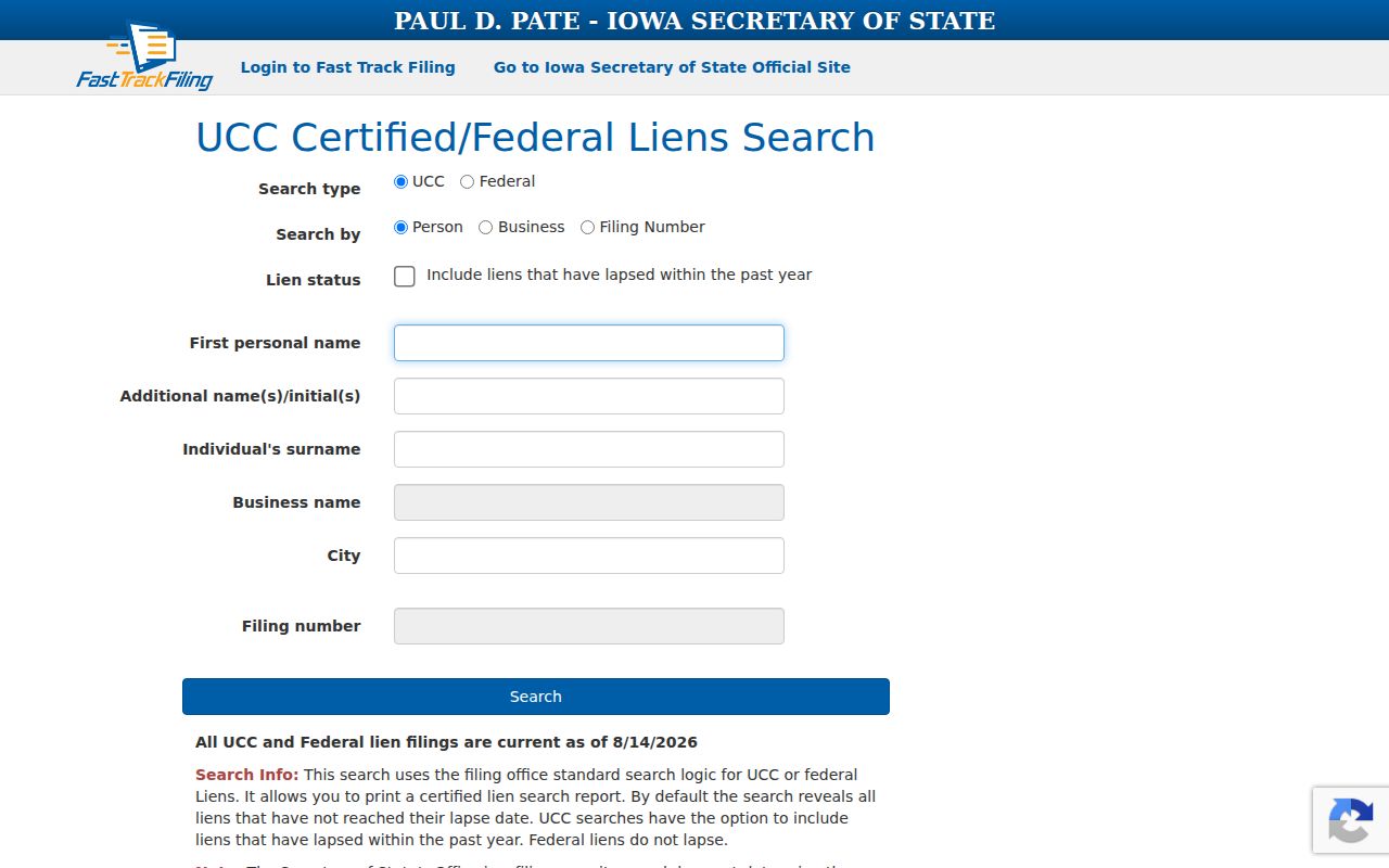
This comparison helps keep a city or ZIP field in context: it narrows that portal's own record family and does not create a general resident list.
The 50467 Mason City Processing-Label Quirk
The strongest local geography lesson is 50467. A 2007 USPS bulletin identifies Rock Falls as the place-name and community-post-office context. A 2025 label table groups 50401, 50402, and 50467 under Mason City processing. Both facts can be true because a mail-processing label is not a corporate-limit map or a preferred last line for every address.
A sound postal search reports the exact USPS-confirmed address result instead of copying the processing city from a container table. Near Rock Falls or another edge, compare USPS with the county parcel service and Mason City limits. The parcel may be in Cerro Gordo County but outside Mason City, and a postal last line may not match the city that governs permits or taxes.
Portal quirk. The county tax search has no ZIP field, so a missing ZIP search option says nothing about whether a parcel record exists.
Community Names Do Not Define Mason City ZIP Codes
Neighborhood and association names are useful local clues, but they are not postal authorities. Asbury Farm publishes its own covenants, guidelines, recreation rules, and board contacts. Those materials can identify the community context around an address, yet they do not establish an official ZIP boundary or a city-approved neighborhood line.
The Asbury Farm association site is the source for the community image assigned to this page.

The same caution applies to any self-published development name. Record it as association-provided, then verify postal geography through USPS and parcel or city jurisdiction through the public map offices.
Mason City ZIP Code Lines Versus City Limits
No single official map was located that overlays ZIP boundaries, Mason City corporate limits, and Cerro Gordo parcels. County GIS is the practical parcel and address-map office, while city GIS supplies municipal-limit and asset layers. For a disputed edge address, compare those sources and ask GIS, Engineering, or Planning about current assignment rules.
County parcel identifiers and legal descriptions answer different questions from postal fields. A situs address keys the parcel or permit. An owner mailing address is used for correspondence. A legal description ties the land to a plat or instrument. None should be silently substituted for another in a postal directory.
- ZIP and ZIP+4
- The five-digit delivery area and an added four-digit segment that narrows mail sorting for an exact route or destination.
- PO-box ZIP
- A code or use tied to post-office-box delivery rather than an assumed street area.
- Unique ZIP
- A code assigned to one organization or destination; no such Mason City assignment was confirmed in the research.
- Carrier route
- A USPS delivery sequence within a broader ZIP, not a municipal boundary.
Recording a Mason City Postal Last Line
A useful research log keeps the address parts structured. Save the house number, directional, street name, suffix, unit, USPS-confirmed city and state, five-digit ZIP, ZIP+4 when returned, source URL, and access date. In a separate field, record city jurisdiction and county parcel ID from GIS. This prevents a processing label from replacing an address-specific result.
For an election lookup, note whether the result concerns a scheduled primary, general, city, or school election. Special-election polling information should be confirmed with the Cerro Gordo Auditor. If a ZIP is absent from the county finder, the county warns that it may belong to a neighboring county, so call the election office rather than guessing.
For a property question, move from the exact street result to the tax or Assessor search and then the Recorder if an instrument is needed. The postal directory supplies the delivery key, but title, occupancy, and city authority each require their own record.
Recheck Mason City ZIP Code Results Before Use
Postal and portal details can change. The research did not produce a complete street-by-street list of local ZIP+4 ranges, a combined ZIP and corporate-limit overlay, or a fully enumerated street-delivery rule for 50402. Those are reasons to check one address at a time, not reasons to fill the gap with an inferred map.
Recheck USPS hours and the exact result when publishing. Also confirm the portal's current fields, since access controls can hide options from an unattended review. Save a screenshot or print record with the URL and date when the postal-city relationship is central to the research.
Boundary caution. A Mason City postal label does not prove Mason City civic jurisdiction or identify who lives at an address.